Can Your Insurance Company Drop You From a Drone Photo?

How Aerial Photography Is Changing Home Insurance

Author profile picture

Susan Meyer

Senior Editorial Manager

Susan is a licensed insurance agent and has worked as a writer and editor for over 10 years across a number of industries. She has worked at The Zebr…

Credentials
  • Licensed Insurance Agent — Property and Casualty
Author profile picture

Beth Swanson

Insurance Analyst

Beth joined The Zebra in 2022 as an Associate Content Strategist. A licensed insurance agent, she specializes in creating clear, accessible content t…

Credentials
  • Licensed Insurance Agent — Property and Casualty
  • Associate in Insurance
  • Professional Risk Consultant

Eyes in the Sky

In recent years, drones and aerial photography have rapidly grown as an industry. The global aerial imaging market size was estimated at USD 3.41 billion in 2024 and is projected to reach USD 8.24 billion by 2030.[1]

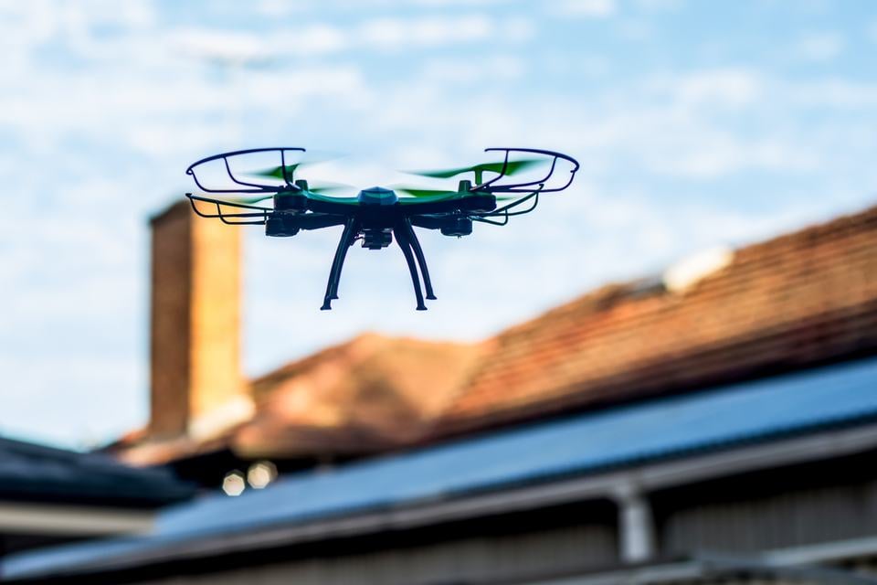
Drone photography and aerial photography have a number of uses, including mapping, urban planning, environmental monitoring, real estate and construction, and this photography has also become a powerful tool for home insurance companies. 

These technologies help insurers evaluate homes with greater accuracy. However, sometimes, this can also have surprising consequences for homeowners.

In this article, we’re looking at the use of aerial photography by home insurance companies. Can they drop your policy or raise your rates based on evidence captured from above? And if so…what can you do?

Why Insurers Use Aerial Photography

It’s not new that home insurance companies sometimes do home inspections as part of the underwriting process when you buy a new policy, especially if you have an older home, or it hasn’t been inspected in a while. Aerial photography can be a component of that, instead of, or in addition to, on-the-ground inspectors. It can also be used during the claims process to assess damage. 

Home insurance companies use aerial photos and drone footage to:

Assess property conditions

High-resolution images can reveal roof damage, missing shingles, aging materials or debris buildup.

Verify policy details

Insurers can confirm square footage, the presence of structures like pools, trampolines, or sheds and other risk factors that affect coverage.

Monitor claims and storm damage

After a hurricane, tornado, or hailstorm, drones can quickly document widespread damage to process claims faster and more safely.

By providing objective data, aerial imaging can help insurers make more consistent underwriting decisions and detect potential fraud.

Can Aerial Data Affect Your Insurance Rates?

Yes. Aerial imagery can directly influence your home insurance premiums in several ways:

  • Higher risk findings: If images show a damaged roof, overgrown trees or neglected maintenance, the insurer may categorize your home as higher risk, leading to a rate increase.

  • Improved conditions: Conversely, if updates like a new roof or repaired siding are visible, you could qualify for a lower premium or renewal discount.

  • Additional features: Some features—like swimming pools, trampolines, or large decks—can raise liability exposure, which may also raise your rates.

Essentially, drone and satellite data give insurers a real-time snapshot of property conditions, allowing them to adjust pricing more dynamically than in the past.

Can Your Policy Be Dropped Because of Aerial Imagery?

Unfortunately, yes. Some homeowners have reported policy nonrenewals after aerial inspections uncovered issues like:

  • Roofs nearing the end of their lifespan
  • Overhanging trees posing storm risks
  • Cluttered yards or debris viewed as fire hazards
  • Unauthorized structures, such as unpermitted sheds or additions

In most cases, insurers must notify you before canceling or refusing renewal, giving you time to address the problems. However, each state has its own rules governing notice periods and acceptable reasons for nonrenewal.

This can also occur even outside of known insurance inspections. People have reported receiving notices from their home insurance companies raising rates or not renewing their policy based on drone photographs they weren’t aware were being taken.[2]

 aerial home view

Laws Around Aerial Photography

In most states insurance companies can use aerial images as part of the assessment process with no prior notice required. State privacy laws generally allow that things that are visible from public air space are outside the expectation of privacy. 

That said, transparency is improving as regulators recognize the growing use of AI and drone data in underwriting. Some states are introducing legislation to require insurers to disclose when automated or third-party imaging data is used in decisions or require notice of when images will be taken. 

Here are some of the laws currently in place or proposed around the use of aerial photos and home insurance.

  • California introduced a bill in 2025 that would require insurance companies to notify homeowners 30 days in advance of taking aerial images on their property.[3]
  • In Pennsylvania, the Unfair Insurance Practices Act, states that insurers must provide 60 days of notice and proof of a significant change to the property in order to not renew it. Aerial photography alone may not be enough proof on its own.[4]
  • Texas has a law that applies to the use of unmanned aircraft capturing imagery of private real estate, but it is still murky on how it applies to home insurance companies.[5]
  • Massachusetts introduced legislation that would regulate the use of aerial photography in coverage decisions. It would require insurers to include steps to appeal the decision along with a non-renewal notice.[6]

Can You Appeal or Challenge a Drone-Based Decision?

If your policy is affected by aerial photography, you have the right to appeal or dispute the findings.

Steps you can take include:

  1. Request the images or report. Ask for copies of the photos your insurer used to make its decision.
  2. Provide your own evidence. This could include recent inspection reports or photos showing completed repairs.
  3. Ask for a reinspection. Some insurers will revisit the property or review updated aerial imagery if you make improvements.
  4. File a complaint. If you believe the insurer acted unfairly or violated notice rules bring it up with your state’s insurance department.

Wrapping Up

Drones and aerial photography are transforming how insurers evaluate homes, often improving efficiency and accuracy. But they also raise new concerns about privacy, fairness and accountability. 

Homeowners should be proactive. Avoid problems by keeping your property well-maintained both inside and out. Ask insurers how aerial data is used, and don’t hesitate to appeal if a drone photo paints an incomplete picture of your home.

Sources
  1. Aerial Photography Market. [Grand View Research]

  2. Kane County woman says Allstate threatened to drop insurance over Google Earth photos. [CBS News]

  3. Commissioner Lara supports legislation to protect homeowners’ privacy and increase transparency in insurers’ use of aerial imagery. [California Department of Insurance]

  4. Shapiro Administration Urges Insurers to Properly Use Aerial Imagery and Verify Damages on Consumer Homes. [Commonwealth of Pennsylvania]

  5. Texas Law Enforcement and Public Protection Chapter 423. [Texas Capitol Statutes]